arcgis中,我想把被选中的两个图斑进行融合(如图),并对AREA字段求和,该怎么做呢?求大神赐教。。急
Posted
tags:
篇首语:本文由小常识网(cha138.com)小编为大家整理,主要介绍了arcgis中,我想把被选中的两个图斑进行融合(如图),并对AREA字段求和,该怎么做呢?求大神赐教。。急相关的知识,希望对你有一定的参考价值。
参考技术A 在图上用编辑工具选中这两个,然后点Editor工具条下来,Merge命令,然后选择合并到哪一个feature上,选中的那个就保留它,另外一个就被合并到选中的那个图斑上了。Area字段也自动更新成新的数据了。追问Area并没有更新成两个图斑面积的和,而是变成被保留的那个的AREA
追答你应该是用的shape数据保存的数据。如果是GeoDatabase(file or Persional or SDE )数据源就会自动,猜测你的数据源应该也是从GeoDatabase中导出的。两种办法:一种你现在右击面积字段,选择Caculate Geometry,选择Area更新面积字段。第二种方法是重新导入到一个GeoDatabase数据存储,然后在GeoDatabase中编辑数据更智能化。 如果需要shape在导出来就OK了。
本回答被提问者和网友采纳Arcgis应用(十三)根据图层字段属性值对图斑进行融合
1.数据和目标
使用数据:湖北省行政区数据 ;
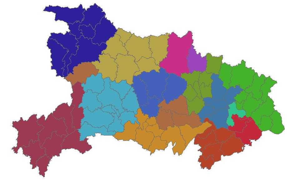
实现目标:根据图层张的CITY字段(地级市编码)属性对地级市中更小一级区划进行合并。
使用工具:Arcgis中的Arctoolbox;
2.实现方法
(1)打开Arcgis中的arctoolbox
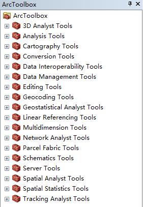
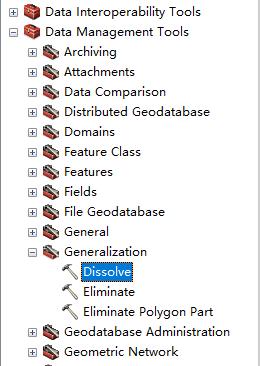
(2)依次打开工具箱Data Management Tools->Generalzation->Dissolve
(3)设置图层和参数
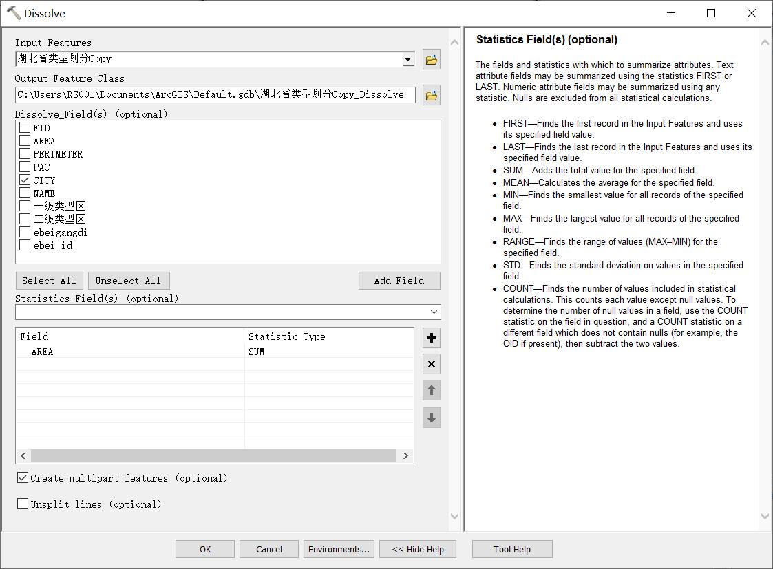
Dissolve_Field(s):融合依据字段;
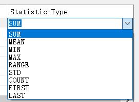
Statistics Field(s):统计字段,比如这里选择面积字段,可以统计多项属性,比如总和、最大值、最小值和平均值等。
- FIRST—Finds the first record in the Input Features and uses its specified field value.
- LAST—Finds the last record in the Input Features and uses its specified field value.
- SUM—Adds the total value for the specified field.
- MEAN—Calculates the average for the specified field.
- MIN—Finds the smallest value for all records of the specified field.
- MAX—Finds the largest value for all records of the specified field.
- RANGE—Finds the range of values (MAX–MIN) for the specified field.
- STD—Finds the standard deviation on values in the specified field.
- COUNT—Finds the number of values included in statistical calculations. This counts each value except null values. To determine the number of null values in a field, use the COUNT statistic on the field in question, and a COUNT statistic on a different field which does not contain nulls (for example, the OID if present), then subtract the two values.
Create Multipart Features(创建多部分要素,比如如果有多个相离的图斑也作为一个图斑):
Specifies whether multipart features are allowed in the output feature class.
- Checked—Specifies multipart features are allowed. This is the default.(默认合并为多部分要素图斑)
- Unchecked—Specifies multipart features are not allowed. Instead of creating multipart features, individual features will be created for each part.
Unsplit lines (optional):(是否融合边线,默认融合(或溶解)到图斑中)
Controls how line features are dissolved.
- Unchecked—Lines are dissolved into a single feature. This is the default.
- Checked—Lines are only dissolved when two lines have an end vertex in common.
(4)输出结果
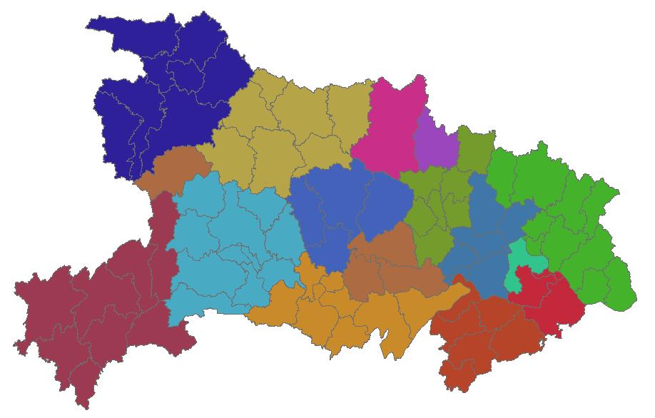
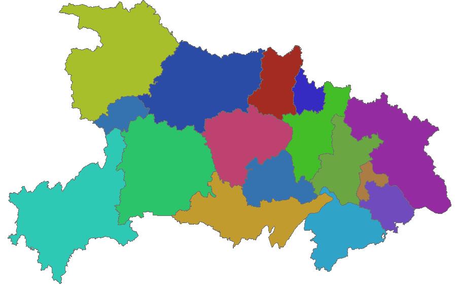
按照以上图中设置参数输出结果(对比图)如下:
(5)属性查看
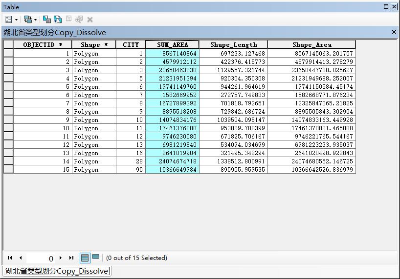
属性表中自动添加了面积字段,但同时也丢失了大部分原有的字段。
以上是关于arcgis中,我想把被选中的两个图斑进行融合(如图),并对AREA字段求和,该怎么做呢?求大神赐教。。急的主要内容,如果未能解决你的问题,请参考以下文章