R语言学习笔记:地理可视化
Posted 阿灿的读书小阁
tags:
篇首语:本文由小常识网(cha138.com)小编为大家整理,主要介绍了R语言学习笔记:地理可视化相关的知识,希望对你有一定的参考价值。
R语言有很多绘制地图的包,如map,maptools或ggmap。
1.气泡地图
library(tidyverse)library(ggsci)library(rgdal)library(Cairo)library(cowplot)map_dataworldData <- map_data('world')set.seed(2020)locations <- tibble(long = c(116.2,-82.22,2.20,23.46,77.13,32.35,-77.02,149.08),lat = c(39.55,23.08,48.5,37.58,28.37,15.31,39.91,-35.15),size = sample(50:100,8))CairoPNG('P1.jpg',height = 1200,width = 2800,res = 300)ggplot()+geom_polygon(data=worldData, aes(x=long, y=lat, group=group),color='black', size=.2, fill='white')+theme_void()+labs(x='', y='')+geom_point(data=locations, aes(x=long, y=lat, size=size),color='gray30', shape=21, fill='#ef4b4b')+scale_size_continuous(range=c(3,5))dev.off()
2.热力地图(单颜色连续渐变填充/单颜色离散填充)
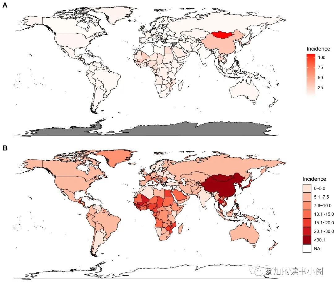
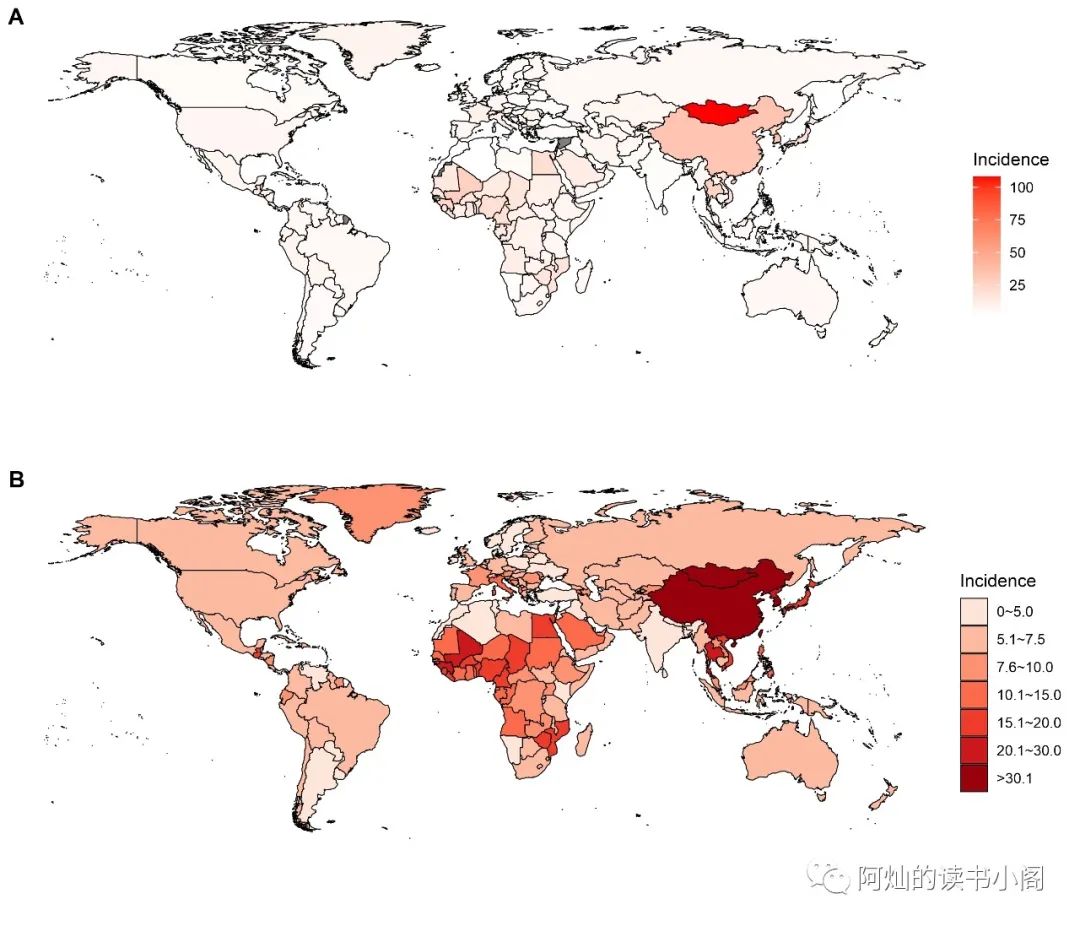
CairoPNG('P2.jpg',height = 2400,width = 2800,res = 300)p <- ggplot()p1 <- p + geom_polygon(data=total,aes(x=long, y=lat, group=group, fill=val),color='black', size=.2)+scale_fill_gradient(low='white', high='red')+theme_void()+labs(x='', y='')+guides(fill=guide_colorbar(title='Incidence'))+theme(legend.position = 'right')total <- total %>% mutate(val2 = cut(val, breaks = c(0,5,7.5,10,15,20,30,110),labels = c("0~5.0","5.1~7.5","7.6~10.0","10.1~15.0","15.1~20.0","20.1~30.0",">30.1"),include.lowest = T,right = T))p2 <- p + geom_polygon(data=total,aes(x=long, y=lat, group = group,fill=val2),colour="black",size = .2) +scale_fill_manual(values = c('#fee5d9','#fcbba1','#fc9272','#fb6a4a','#ef3b2c','#cb181d','#99000d'))+theme_void()+labs(x="", y="")+guides(fill = guide_legend(title='Incidence'))+theme(legend.position = 'right')plot_grid(p1,p2,ncol=1,align = 'v',labels = c('A','B'))dev.off()
这是画出来带南极洲和缺失值的图

修饰后的图

3.热力地图(双颜色连续渐变填充/双颜色离散填充)
set.seed(2020)apcs <- tibble(apc = c(rnorm(nrow(country_asr)-10,0,2),rep(0,10)),location = unique(country_asr$location))head(apcs)worldData <- map_data('world')total <- left_join(worldData, apcs, by=c('region' = 'location'))#画图CairoPNG('P3.jpg',height = 2400,width = 2800,res = 300)p <- gglot()p1 <- p + geom_polygon(data=total,aes(x=long, y=lat, group=group, fill=apc),colour='black', size=.2)+scale_fill_gradient2(low='forestgreen', mid='white',high='red',midpoint=0)+theme_void() + labs(x='', y='')+guides(fill=guide_colorbar(title='APC'))+theme(legend.position = 'right')#离散化total <- total %>% mutate(apc2 = cut(apc, breaks = c(-5.5,-2.5,-0.0001,0.0001,2.5,5.3),labels = c("-5.50~-2.50","-2.49~0",0,"0~2.50","2.51~5.30"),include.lowest = T,right = T))p2 <- p + geom_polygon(data=total,aes(x=long, y=lat, group = group,fill=apc2),colour="black",size = .2) +scale_fill_manual(values = c('#238b45','#a1d99b','gray90','#fcbba1','#fb6a4a'))+theme_void()+labs(x="", y="")+guides(fill = guide_legend(title='APC'))+theme(legend.position = 'right')plot_grid(p1,p2,ncol=1,align = 'v',labels = c('A','B'))dev.off()
可以将缺失值去掉
4.中国地图
library(rgdal)#在官网下载中国地图shp文件china <- readOGR('test\bou2_4m\bou2_4p.shp')#将数据转换为数据框形式china2 <- fortify(china)mymap <- china@datamymap$id <- 0:924china.map2 <- plyr::join(mymap,china2)mydata <- read.csv('test\data2.csv')datamap <- full_join(china.map2,mydata)df_China <- datamap#绘制九段线Width<-9Height<-9long_Start<-124lat_Start<-16df_Nanhai<-df_China[df_China$long>106.55 & df_China$long<123.58,]df_Nanhai<-df_Nanhai[df_Nanhai$lat>4.61 & df_Nanhai$lat<25.45,]min_long<-min(df_Nanhai$long, na.rm = TRUE)min_lat<-min(df_Nanhai$lat, na.rm = TRUE)max_long<-max(df_Nanhai$long, na.rm = TRUE)max_lat<-max(df_Nanhai$lat, na.rm = TRUE)df_Nanhai$long<-(df_Nanhai$long-min_long)/(max_long-min_long)*Width+long_Startdf_Nanhai$lat<-(df_Nanhai$lat-min_lat)/(max_lat-min_lat)*Height+lat_Startdf_Nanhai$class<-rep("NanHai",nrow(df_Nanhai))df_China$class<-rep("Mainland",nrow(df_China))df_China<-rbind(df_China,df_Nanhai)df_NanHaiLine <- read.csv("test\中国南海九段线.csv")colnames(df_NanHaiLine)<-c("long","lat","ID")df_NanHaiLine$long<-(df_NanHaiLine$long-min_long)/(max_long-min_long)*Width+long_Startdf_NanHaiLine$lat<-(df_NanHaiLine$lat-min_lat)/(max_lat-min_lat)*Height+lat_StartCairoPNG('P4.jpg',height = 2400,width = 2800,res = 1200)p1 <- ggplot()+geom_polygon(data=df_China,aes(x=long,y=lat,group=interaction(class,group),fill=HBOR),colour="black",size=0.25)+#绘制矩形边框geom_rect(aes(xmin=long_Start, xmax=long_Start+Width+0.8,ymin=lat_Start-0.6, ymax=lat_Start+Height),fill=NA,colour="black",size=0.25)+#绘制边框内部地图边界线条geom_line(data=df_NanHaiLine, aes(x=long, y=lat, group=ID),colour="black", size=1)+scale_fill_gradient2(low = "green",mid = 'white', high = "red",midpoint = 1)+coord_cartesian()+ylim(15,55)+theme_void()+labs(x="", y="")+theme(legend.position=c(0.15,0.2),legend.background = element_blank())dev.off()
以上是关于R语言学习笔记:地理可视化的主要内容,如果未能解决你的问题,请参考以下文章