将 Street View Text 数据集的 GroundTruth 标注在图像上
Posted chenxp2311
tags:
篇首语:本文由小常识网(cha138.com)小编为大家整理,主要介绍了将 Street View Text 数据集的 GroundTruth 标注在图像上相关的知识,希望对你有一定的参考价值。
自然场景图像,Street View Text 数据集是非常著名的一个数据集。所有的图像都源自于 Google Street View,这里面的图像分辨率较低,文字变化较大。

数据集给定的 ground truth 是两个 XML 文件: train.xml、test.xml,示例如下:
<?xml version="1.0" encoding="utf-8"?>
<tagset>
   <image>
      <imageName>img/14_03.jpg</imageName>
      <address>341 Southwest 10th Avenue Portland OR</address>
      <lex>LIVING,ROOM,THEATERS,KENNY,ZUKE,DELICATESSEN,CLYDE,COMMON,ACE,HOTEL,PORTLAND,ROSE,CITY,BOOKS,STUMPTOWN,COFFEE,ROASTERS,RED,CAP,GARAGE,FISH,GROTTO,SEAFOOD,RESTAURANT,AURA,RESTAURANT,LOUNGE,ROCCO,PIZZA,PASTA,BUFFALO,EXCHANGE,MARK,SPENCER,LIGHT,FEZ,BALLROOM,READING,FRENZY,ROXY,SCANDALS,MARTINOTTI,CAFE,DELI,CROWSENBERG,HALF</lex>
      <Resolution x="1280" y="880"/>
      <taggedRectangles>
         <taggedRectangle height="75" width="236" x="375" y="253">
            <tag>LIVING</tag>
         </taggedRectangle>
         <taggedRectangle height="76" width="175" x="639" y="272">
            <tag>ROOM</tag>
         </taggedRectangle>
         <taggedRectangle height="87" width="281" x="839" y="283">
            <tag>THEATERS</tag>
         </taggedRectangle>
      </taggedRectangles>
   </image>

......
那么怎么将这里面标出的 ground truth 框框,框到原图像中呢?
我写了一个 python 脚本,通过解析 XML 文件,将框框放到原图上。通过这段代码,你可以学会怎么样去 Parse 一个 XML 文件。
代码如下:
import os, sys
import glob
from PIL import Image
from PIL import ImageDraw

from xml.etree import ElementTree

train_XML_src_dir = '/media/chenxp/Datadisk/ocr_dataset/StreetViewTextDataset/svt1/train.xml'
test_XML_src_dir = '/media/chenxp/Datadisk/ocr_dataset/StreetViewTextDataset/svt1/test.xml'

images_src_dir = '/media/chenxp/Datadisk/ocr_dataset/StreetViewTextDataset/svt1/'
images_save_dir = '/media/chenxp/Datadisk/ocr_dataset/StreetViewTextDataset/svt1/img_groundtruth'

with open(train_XML_src_dir) as f:
    tree = ElementTree.parse(f)


train_fd = open('train.txt', 'w')

for node in tree.iter('image'):
    img_name = [] # 记录保存图像名
    for each_image in node:
        if each_image.tag == 'imageName':
            img_name.append(each_image.text[4::]) # 记录保存图像名

            tmp_img = Image.open(images_src_dir + each_image.text)
            tmp_draw = ImageDraw.Draw(tmp_img)

            train_fd.write(images_src_dir + each_image.text + '\\n') # 将路径写入 txt 文件

        if each_image.tag == 'taggedRectangles':
            count = 0 # count the number of taggedRectangle
            x = []; y = []
            width = []; height = []
            for each_taggedRect in each_image:
                count = count + 1
                tmp_dict = each_taggedRect.attrib # 获取坐标信息,得到的为字典
                x.append(tmp_dict['x']); tmp_x = int(tmp_dict['x'])
                y.append(tmp_dict['y']); tmp_y = int(tmp_dict['y'])
                width.append(tmp_dict['width']); tmp_w = int(tmp_dict['width'])
                height.append(tmp_dict['height']); tmp_h = int(tmp_dict['height'])
                tmp_draw.polygon((tmp_x, tmp_y, tmp_x + tmp_w, tmp_y, tmp_x + tmp_w, tmp_y + tmp_h, tmp_x, tmp_y + tmp_h), outline='red')

            tmp_img.save(os.path.join(images_save_dir, img_name[0]))
            train_fd.write(str(count) + '\\n')

            for i in xrange(len(x)):
                train_fd.write(str(x[i]) + ',' + str(y[i]) + ',' + str(width[i]) + ',' + str(height[i]) + ',\\n')

train_fd.close()
运行后,会产生两个文件。一个是标注 ground truth 的图像,一个是我自己需要的 txt 文件,其文件格式如下:
/home/chenxp/.../.../***.jpg # 图像绝对路径
3                            # 这张图像 ground truth 的个数
x1, y1, w, h                 # 本张图像的 ground truth 的坐标信息
x1, y1, w, h
...
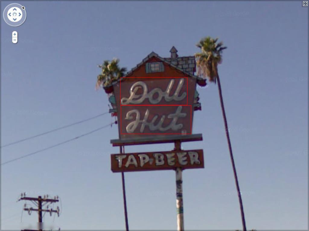
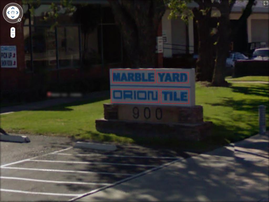
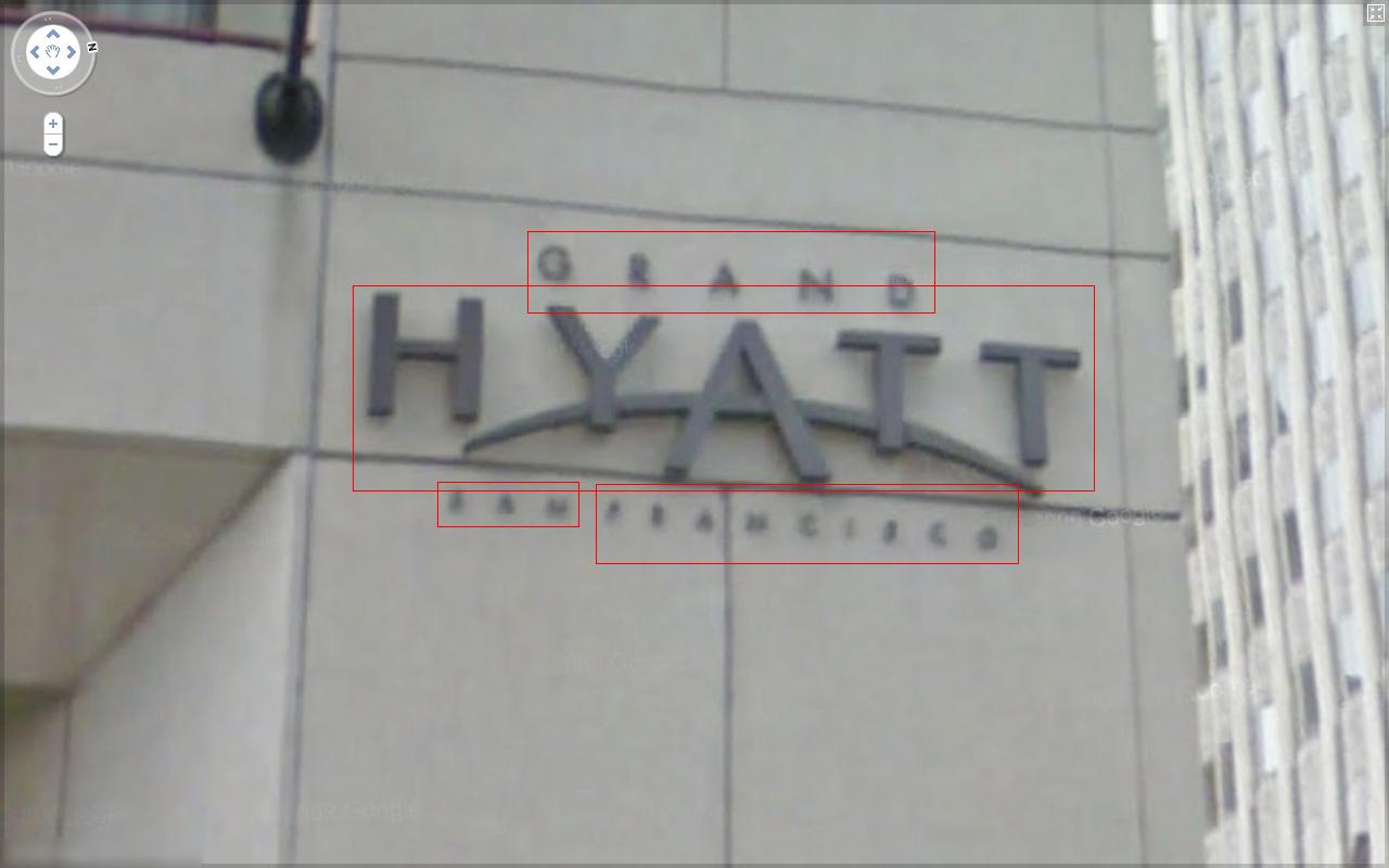
几个图像示例:


鉴于 SVT 原先的 UC 地址:http://vision.ucsd.edu/~kai/svt/,已经不能正常访问了(至少我今天访问了好几次,都无法正常访问)。
我将 SVT 数据集上传到云端,包括我自己生成的标注好的图像:Street View Text Dataset
还有,如果想自己下载 SVT 数据集,可以到这个网址上注册下载:http://tc11.cvc.uab.es/datasets/SVT_1
以上是关于将 Street View Text 数据集的 GroundTruth 标注在图像上的主要内容,如果未能解决你的问题,请参考以下文章
cf gym102059G. Fascination Street(四维dp)
Caliburn.Micro 无法匹配来自不同程序集的 View 和 ViewModel