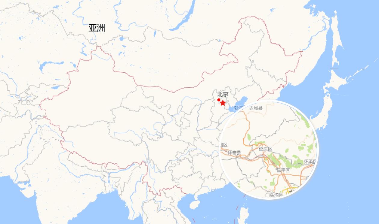
地图放大镜的实现
Posted 牛老师讲GIS
tags:
篇首语:本文由小常识网(cha138.com)小编为大家整理,主要介绍了地图放大镜的实现相关的知识,希望对你有一定的参考价值。
概述
闲来无事,就做一个花里胡哨的功能:地图放大镜,从中可以学习:1、根据坐标计算对应级别的切片;2、canvas绘图。
实现效果

实现思路
- 注册
map的pointermove事件; - 通过当前级别+放大级别,计算当前坐标所在放大级别对应的切片;
- 请求切片图片,并绘制到canvas上面;
实现代码
const tileSize = 256
const canvas = document.createElement('canvas')
canvas.width = tileSize
canvas.height = tileSize
const ctx = canvas.getContext('2d')
const scale = 4
canvas.classList.add('canvas')
map.getTargetElement().appendChild(canvas)
function getCoordsTile(coords)
  let resolution = 156543.03392804097
  let resolutions = []
  for (let i = 0; i < 19; i++)
    resolutions.push(resolution)
    resolution = resolution/ 2

  const val0 = resolutions[0] * tileSize / 2
  const originX = -val0
  const originY = val0
  let zoom = Math.ceil(map.getView().getZoom()) + scale
  zoom = zoom > 18 ? 18: zoom
  const res = resolutions[zoom] * tileSize
  const x = Math.floor((coords[0] - originX) / res)
  const y = Math.floor((originY - coords[1]) / res)
  return zoom, x, y

// 地图拖动和缩放事件
map.on('pointermove', function (e)
  vecSource.clear()
  const pixel = e.pixel
  const coords = e.coordinate
  const feature = new ol.Feature(
    geometry: new ol.geom.Point(coords)
  )
  vecSource.addFeature(feature)
  const zoom, x, y = getCoordsTile(coords)
  let url = options.tileUrl.split('z').join(zoom)
  url = url.split('x').join(x)
  url = url.split('y').join(y)
  const img = new Image()
  img.src = url
  img.onload = function ()
    ctx.beginPath()
    ctx.arc(tileSize / 2, tileSize / 2, tileSize / 2, 0, Math.PI * 2)
    ctx.clip()
    ctx.drawImage(img, 0, 0)
    canvas.style.left = pixel[0] + 'px'
    canvas.style.top = pixel[1] + 'px'

)
以上是关于地图放大镜的实现的主要内容,如果未能解决你的问题,请参考以下文章